


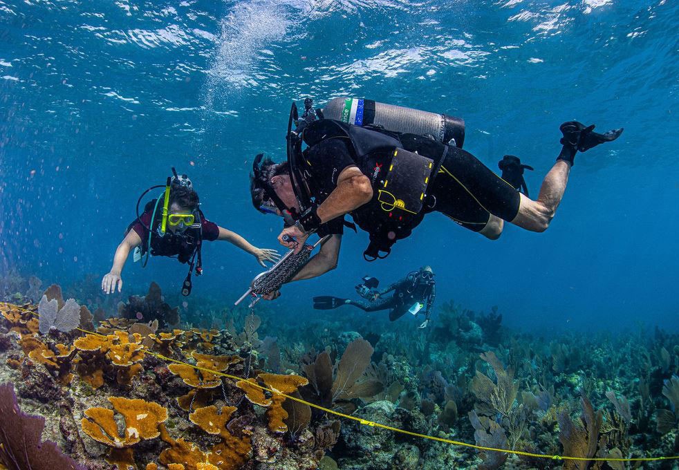
A University of Georgia researcher has received funding to create an artificial intelligence tool expected to greatly improve mapping of coral reefs and lead to significant advancements in underwater 3D measurements—information that will aid efforts to help these reefs survive.
Jim Porter, professor emeritus in the Odum School of Ecology, is co-principal investigator on a National Science Foundation grant for CoralReef3D, a computational toolset integrating advanced 3D and photogrammetric techniques that will be made available to divers and coastal surveyors all over the world.
“Coral reefs are under horrific threats from climate change and disease. But some reefs are holding on,” said Porter, a coral ecology expert. We need to find them and study them for the success stories they tell. Our new GPS mapping software will do this.”
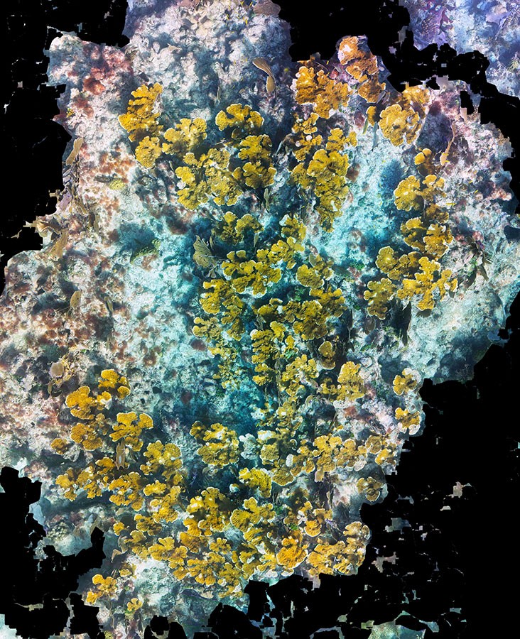
Coral reefs are one of the most diverse ecosystems on Earth, supporting 25% of marine species and providing protein and income for 5% of humanity. But most are in decline due to climate change and other stressors. Warmer temperatures in oceans is one cause of coral bleaching—when corals expel the algae living in their tissues and turn completely white.
Traditional surveying methods for coral reefs are expensive, time consuming and require the expertise of scientists. CoralReef3D will allow non-experts to create georeferenced (and therefore repeatable) 3-D montages that can easily be assessed for studies on coral growth and survival. The toolset will also speed up the evaluation process by using AI to auto-analyze images and identify locations where disease is prevalent, as well as identifying healthy reefs.
“In the natural world, pattern is process. Pattern tells you how an ecosystem is functioning and therefore whether or not it is healthy,” Porter said. “AI is really good at pattern recognition. We will harness this power to help protect coral reefs.”
Finding resilient reefs will allow researchers to examine why they’re healthy and explore strategies for protecting them.
“This project is a brilliant example of how AI can accelerate research to benefit an ecosystem that’s vital to both the planet and her people,” said Mark Hunter, dean of the Odum School of Ecology. “There is limited time to address climate-related issues, and tools like CoralReef3D will be essential for conservation efforts.”
In addition to expanding the number of people who can collect coral reef data, CoralReef3D’s impact will be broadened through open-source software, online workshops, student training, and outreach activities involving museums and the general public.
The team also includes principal investigator Rongun Qin, photogrammetry and computer scientist, and co-principal investigator Andrea Grotolli, coral physiology expert, both from Ohio State University.